

Transit & Trails: Find, Plan, Share app for iPhone and iPad
Developer: Bay Area Open Space Council
First release : 27 Jan 2011
App size: 5.19 Mb
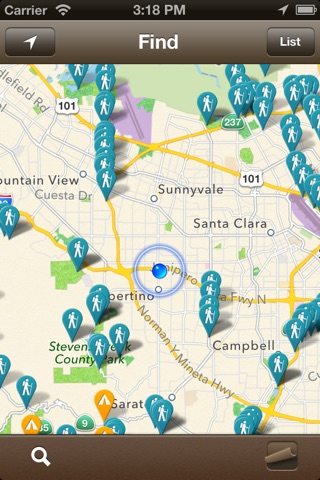
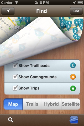
- What parks and trails are near my home?
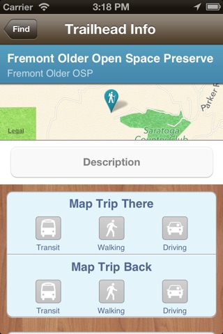
- How do I get there?
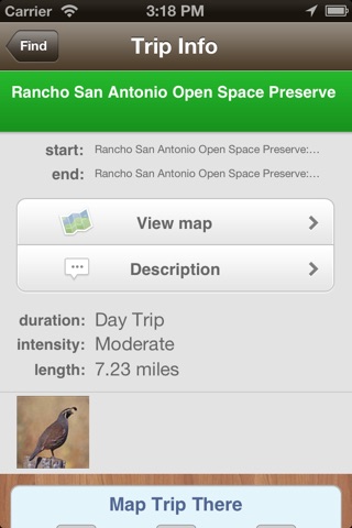
- Can I plan a hike (or ride or run or...) with my friends?
- What if I don’t have a car... can I still go outdoors?
Transit and Trails connects you to parks and open spaces by helping you Find, Plan and Share your outdoor adventures. You can locate trailheads near you (or any location) and we help you get there on public transportation or get the directions you need to walk, bike, or drive there. You might try one of the many existing trips on the site or create a new one. You can then share your plans with a link for an email, an Evite or post the trip to Facebook and Twitter. After your hike, share pictures and your experience on Transit and Trails and join the community of people who care about and love exploring the outdoors.
Transit and Trails is a project of the Open Space Council, a nonprofit focused on providing a vision, being the collective voice, and serving as a central hub for the land conservation community in the San Francisco Bay Area. Our members work tirelessly to protect land, conserve flora and fauna, maintain trails, and make open spaces accessible. Transit and Trails is an important part of our efforts to bring nature within reach of all Bay Area residents.
Have a great idea for how we can improve T&T? Send your thoughts to [email protected]. Your input contributes to our development, helping make Transit & Trails the best app for car-free outdoor adventure.
Transit & Trails is brought to you by the Bay Area Open Space Council, openspacecouncil.org